
Research
My research spans the fields of hydrology, atmospheric science, natural hazard prediction, weather, climate, geospatial analysis, and the physics of fluids. My research combines a drive for understanding the statistics of complex spatial patterns, a passion for the processes that drive interaction between the land and the atmosphere, and a penchant for connecting diverse environmental datasets to improvements in model representation of the Earth System and Natural Hazards. I am eager to engage with any students and researchers that are looking to use atmospheric modeling (LES, NWP, ESM, weather, climate and air pollution prediction models), meteorological tower data, and/or geospatial analysis to answer key environmental and engineering questions, especially when focused on the interaction between the land surface (topography, land-use, human development, vegetation, soil moisture) and the atmosphere. Within this broad group, my focus areas are:
Turbulence and Exchange Between the Land and Atmosphere
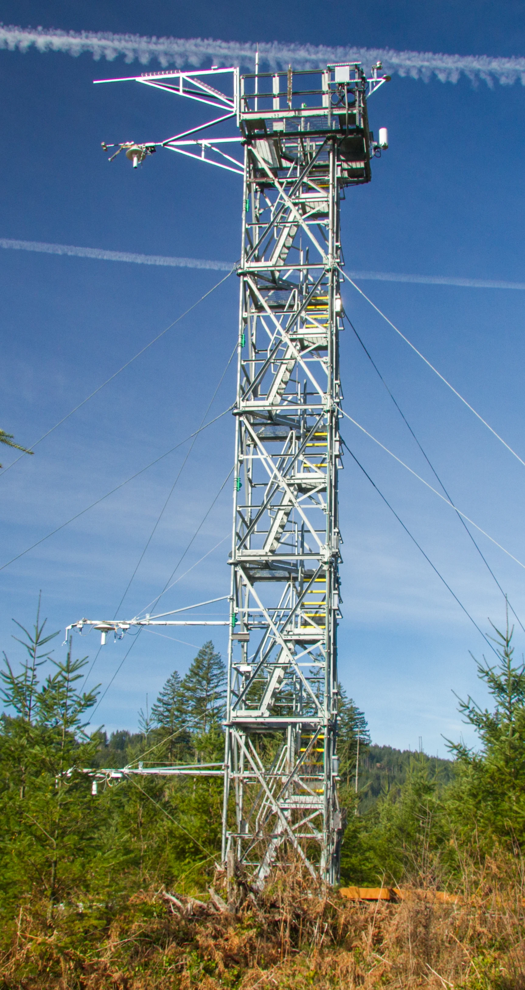
Key Topics: Turbulence, flux tower, evaporation, ecohydrology, carbon cycle, fluid dynamics
Key Questions: How can we understand, and better predict, the exchange of energy, water, carbon and pollutants between the land and atmosphere in complex ecosystems?
Some Project Areas and Broad Questions
- How sensitive are weather, climate, and pollution spread modeling to how we represent surface exchange?
- Do idealized theories for surface exchange hold across different temporal scales?
- What are the key differences in behavior of water, carbon and energy exchange between different ecosystems? What controls and causes these differences?
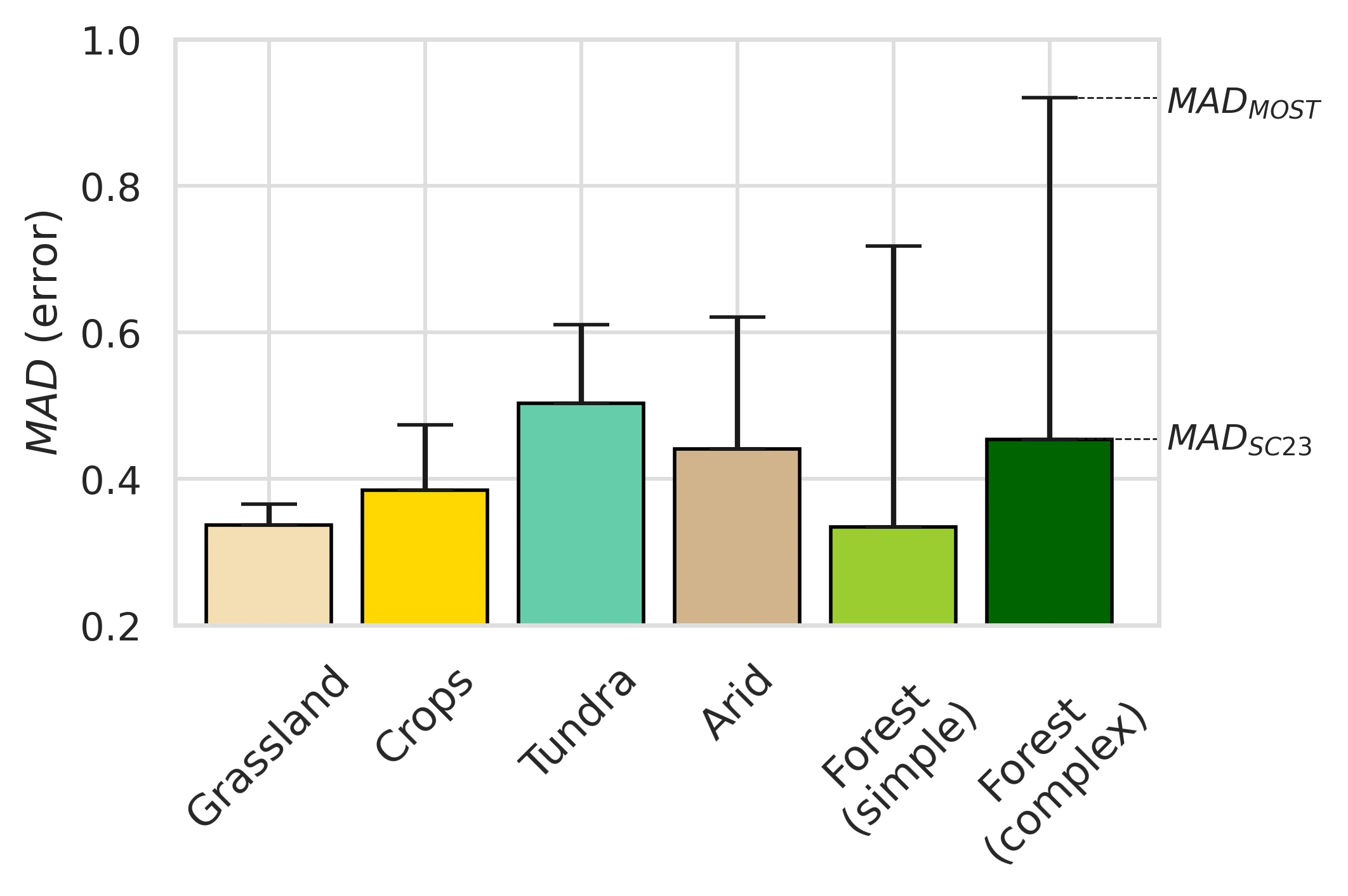
- Waterman, T., Stiperski, I., Torres-Rojas, L., Calaf, M. (2026). Impact of heterogeneity on scalar flux variance relations across diverse ecosystems. Agricultural and Forest Meteorology, 384, 111167
- Waterman, Tyler S., Stiperski, Ivana, Chaney, Nathaniel, Calaf, Marc (2026). Evaluating anisotropy-based Monin–Obukhov similarity theory over canopies and complex terrain. Quarterly Journal of the Royal Meteorological Society, e70206
The Land-Atmosphere Impact of Complex Spatial Patterns
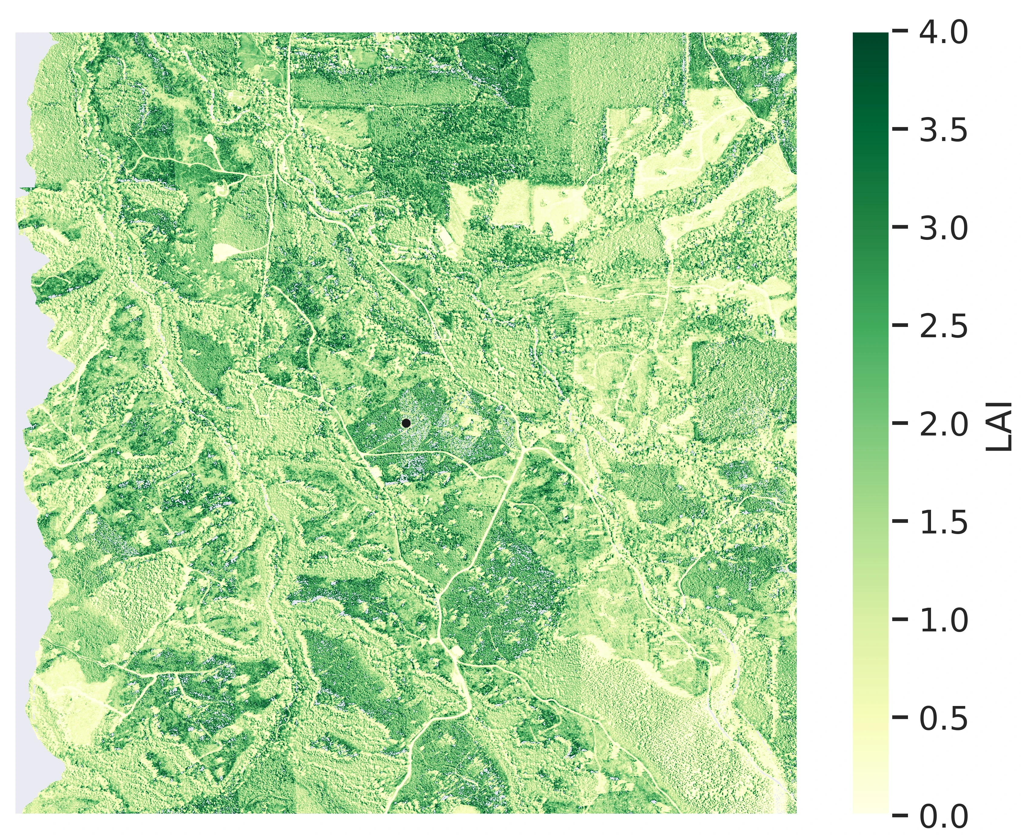
Key Topics: remote sensing, geospatial analysis, natural hazards, environmental data, land use change
Key Questions: What impact do complex patterns of the land surface have on natural hazards (urban heat island, flooding, pollution spread) and the atmosphere and how do humans, engineers, and urban planners influence these patterns? Can we better quantify the key scales for impact?
Some Project Areas and Broad Questions
- Understanding how different patterns of urban greening, adding trees and other vegetation to urban areas, may reduce the impacts of heat waves.
- Do spatial patterns significantly affect our measurements for surface exchange? Can we quantify this?
- Can we better represent engineered systems (solar power, irrigation, urban development) in large scale models?
- What are key spatio-temporal characteristics of precipitation and natural hazards? What controls these spatio-temporal characteristics?
- Waterman, T., Stiperski, I., Torres-Rojas, L., Calaf, M. (2026). Impact of heterogeneity on scalar flux variance relations across diverse ecosystems. Agricultural and Forest Meteorology, 384, 111167
- Torres‐Rojas, L., Waterman, T., Cai, J., Zorzetto, E., Wainwright, H. M., Chaney, N. W. (2024). A Geostatistics‐Based Tool to Characterize Spatio‐Temporal Patterns of Remotely Sensed Land Surface Temperature Fields Over the Contiguous United States. Journal of Geophysical Research: Atmospheres, 129, e2023JD040679
Multi-scale Prediction for Weather, Climate and Air Quality
Key Topics: rainfall, exchange, circulations, clouds, pollution spread, improving prediction
Key Questions: How do we reconcile physics and data when our scale for predicting the environment does not match with the scales of key processes or the scales of human/engineering/environmental impact?
Some Project Areas and Broad Questions
- What errors are caused in weather/climate prediction by the mismatch in scales between the land and atmosphere?
- Will higher resolution precipitation in models yield better prediction for localized drought, agriculture, and ecosystem modeling?
- Can we reliably predict the impact of heterogeneity driven circulations (i.e. sea breeze)?
- Can we use LiDAR to measure 3 dimensional flows in the atmosphere that, previously, have not been quantified directly?
- How do local flows and heterogeneity impact the initiation of convective thunderstorms?
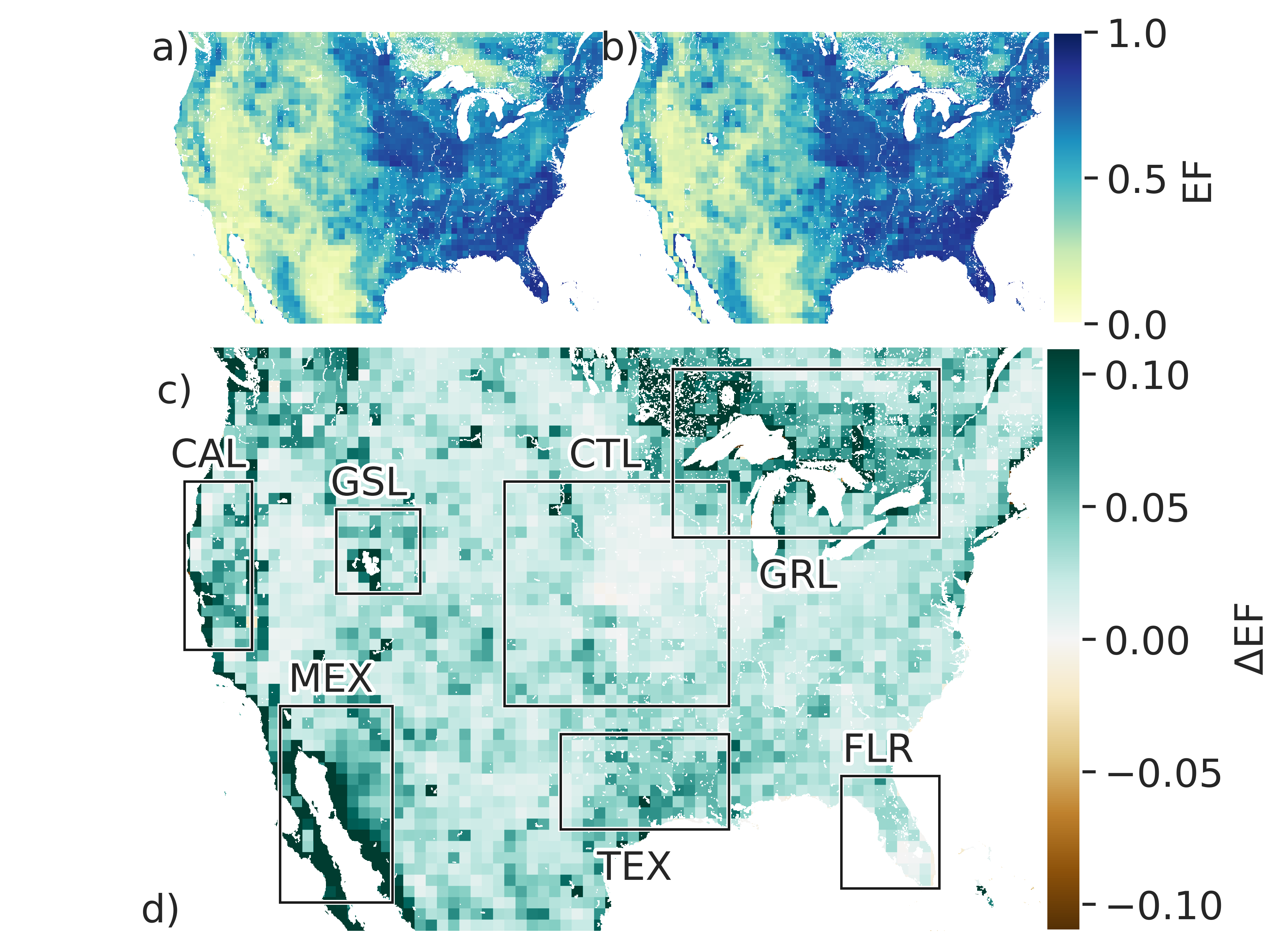
- Waterman, Tyler, Dirmeyer, Paul, Chaney, Nathaniel (2025). Surface Flux Homogenization and its Impacts on Convection Across CONUS. Journal of Hydrometeorology
- Waterman, T., Bragg, A. D., Hay‐Chapman, F., Dirmeyer, P. A., Fowler, M. D., Simon, J., Chaney, N. (2024). A Two‐Column Model Parameterization for Subgrid Surface Heterogeneity Driven Circulations. Journal of Advances in Modeling Earth Systems, 16, e2023MS003936
- Waterman, T., Germ, P., Calaf, M., Pardyjak, E., Chaney, N. (2026). A Satellite Remote Sensing and Doppler LiDAR-based Framework for Evaluating Mesoscale Flows Driven by Surface Heterogeneity. Preprint.